I've posted about Tibet several times on this blog. I found this interesting post via Facebook:
Showing posts with label Rivers of India. Show all posts
Showing posts with label Rivers of India. Show all posts
Sunday, March 10, 2024
Thursday, February 21, 2013
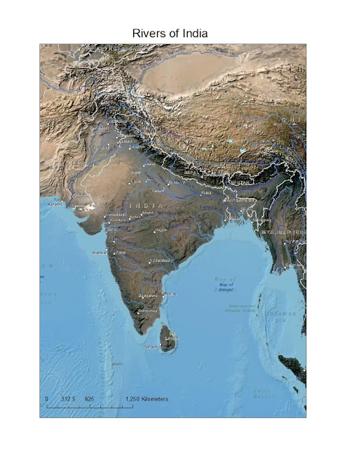
Rivers of India with Landsat imagery
Here is another map I created of the rivers of India, this time with Landsat imagery:
You may download the map of the rivers of India in JPEG format or the map of the rivers of India in PDF format. Alternatively, if you would like to play around with the map itself, download the ArcMap document showing the rivers of India.
Location:
India
Thursday, February 14, 2013
Rivers of India
My rating: 2 of 5 stars
Cheap pressing. Simplistic text. Single fold-out map features rivers symbolized with thick blue lines. Would have liked more detailed maps for each of the chapters.
View all my reviews
OK, I would have liked better maps, so I created my own with data in ArcMap, using free data from Esri:
 |
| Rivers of India |
The map has been formatted to a standard 8.5" x 11" sheet (US).
You may download the JPEG image of Rivers of India or the PDF file of Rivers of India from Google Drive. One problem is the overprint of place names, but I couldn't toggle the options on and off. :-(
Alternatively, if you would like to play around with the data itself download the Rivers of India ArcMap document (.mxd).
Alternatively, if you would like to play around with the data itself download the Rivers of India ArcMap document (.mxd).
Location:
India
Subscribe to:
Posts (Atom)

